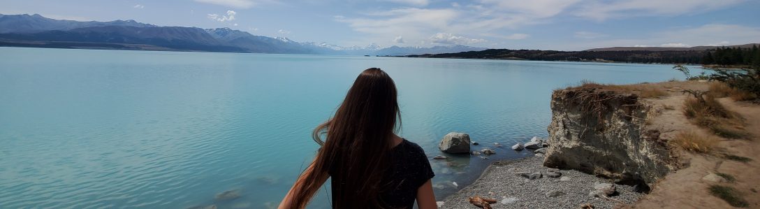
We love visiting National Parks and we are so fortunate to have Shenandoah National Park right in our backyard! Last year for our anniversary trip, we visited the nearby New River Gorge National Park in West Virginia. Looking at a map, I discovered that Great Smoky Mountains National Park is only 5.5 hours away from us! That may seem far to some people, but we don’t mind a road trip. So this year for our wedding anniversary (5 years!), I planned a backpacking and camping trip to the Smokies. Time to add another stamp to our national park passport!
Day 1
We drove to a hotel in Gatlinburg the night before, so we started our day by packing up our hiking bags in preparation for our overnight camping trip. Once we were ready, we drove to the Sugarlands visitor center to check it out and get our national park passport stamped. There is a museum there that displays taxidermy examples of the diversity of animal and plant life in the park.
Once we’d seen everything in the museum, we drove about 15 minutes down the main road, Newfound Gap Road/US Route 441, to the parking area for the Alum Cave Bluffs trail. Along the way, we stopped at a few lookouts to admire the mountains. Even though we live in a mountain area, we could tell we were in a different mountain range and we enjoyed the unique beauty.
The Alum Cave trail is pretty popular, so there were cars parked along both sides of the road near the trailhead parking lot. We figured we would try the parking lot anyway and ended up getting a nice spot! It’s a popular trail for day-hiking, but since we were going to be backpacking and leaving our car overnight, we were glad to have the car in the lot and off the road.
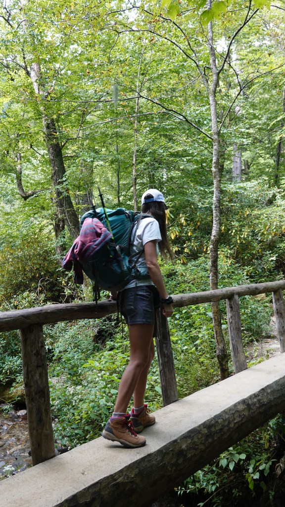
After using the privies at the trailhead, we started our ascent around noon. Our hike was only 5 miles and 2,759 ft elevation gain, so we didn’t need all day to complete it. We locked the car, strapped on our heavy overnight backpacks, and started on the trail.
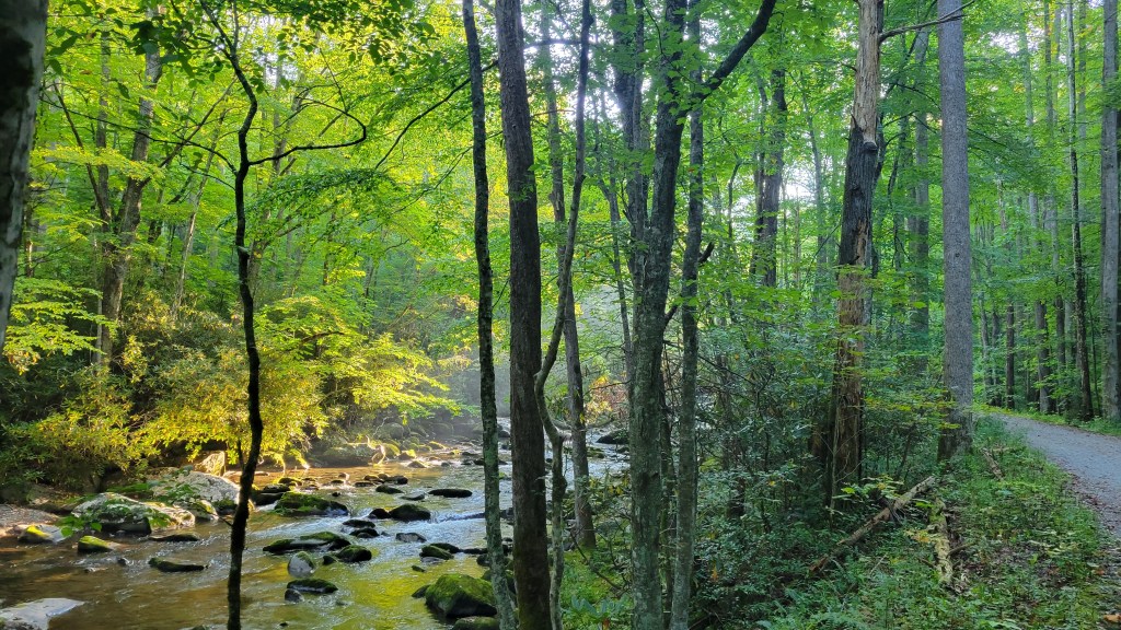
The first mile and a half of the trail follows Alum Cave Creek and isn’t too steep.

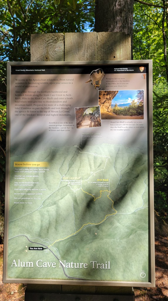
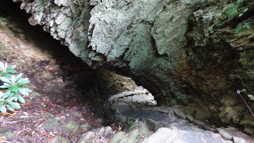
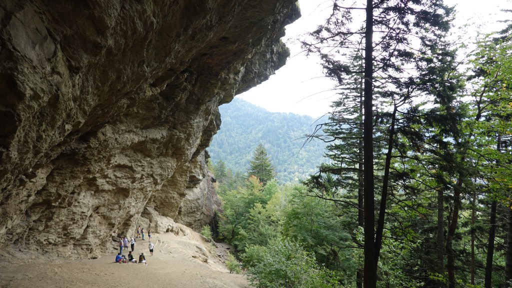
At 1.4 miles, we encountered our first landmark: Arch Rock. The trail goes right through a large hole in a rock and the steps act like a spiral staircase.

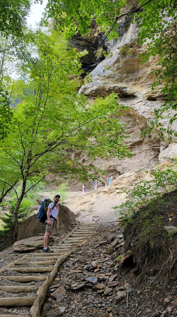
Up next at 2.3 miles in was the Alum Cave Bluff, the trail’s namesake. It’s more like a huge cliff overhang rather than a cave, and it is pretty epic! A lot of people rest here and most turn around at this point. We had 2.7 miles to go to the top of Mt LeConte, so we took a break on a rock under the cliff and ate our lunch of apples and peanut butter. I was carrying the two apples in my bag, so I was very happy to have their weight off of my back for the second half of our hike!
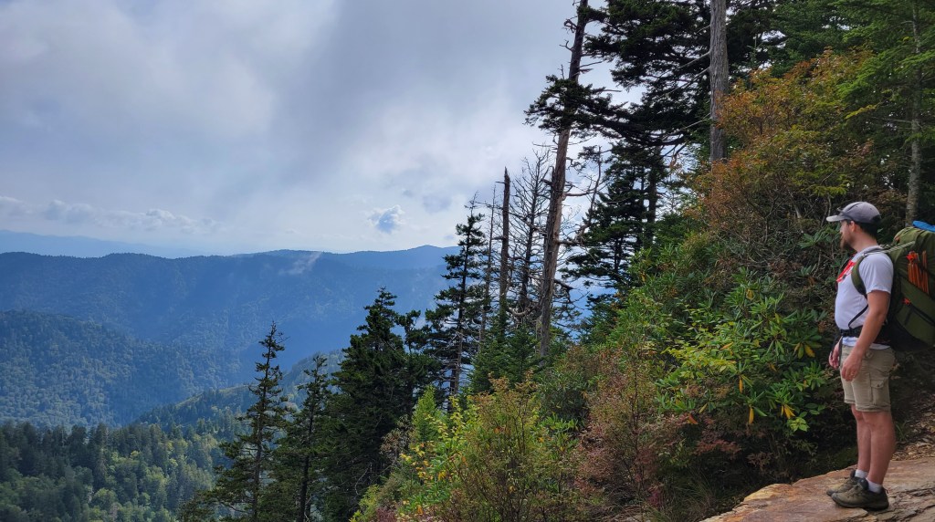
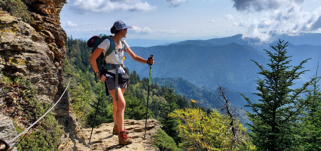
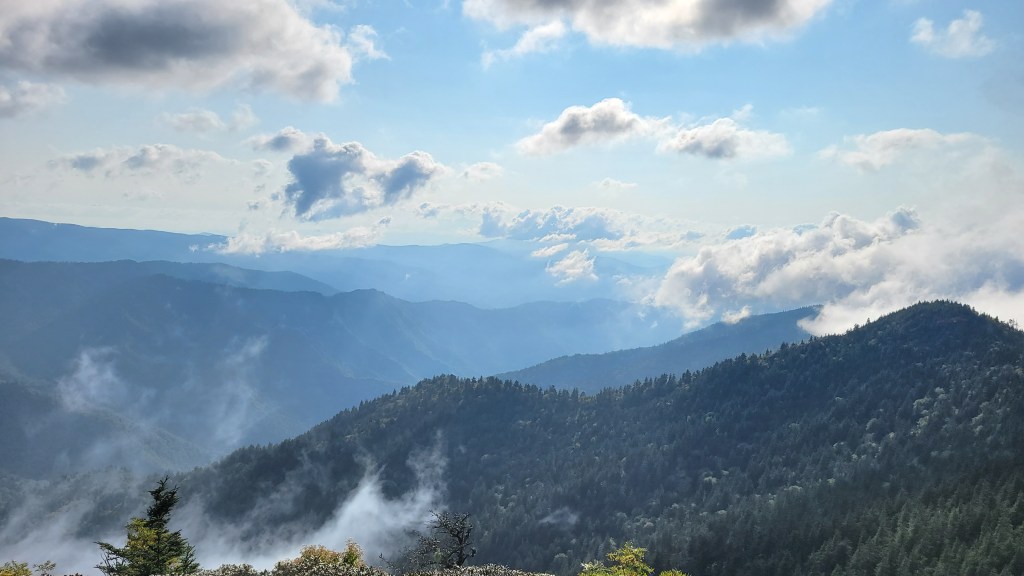
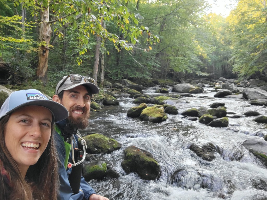
The views from the bluffs to the peak were spectacular. The trail has some rocky parts with a thick metal rope to hold on to in case you lose your footing.

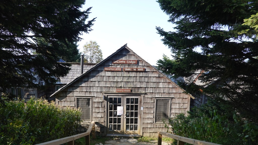
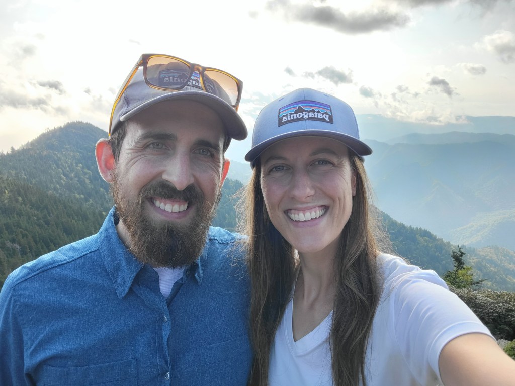
We made it to the summit of Mt LeConte around 4:30pm. There is lodging at the top, called LeConte Lodge, where guests can stay in small cabins and eat food prepared for them. There are public restrooms and potable water, so we were excited to be able to use these facilities even though we weren’t staying there. The cabins get booked up far in advance so instead we camped at the backcountry shelter about a quarter mile down the trail. You need a permit to camp in the backcountry and it only costs $8. I’m not sure how much it costs to stay in one of the cabins. The woman at the LeConte Lodge office told us they get supplies a few times a week via alpaca.
There were a few guys at the shelter when we arrived, so we greeted them and then searched the surrounding area for a nice flat spot for our tent. We decided on a mossy spot among the trees that was as level as we could find. It only takes us about two minutes to set up our tent, so we did that and walked back to the lodge area without our heavy bags so we could explore the area.
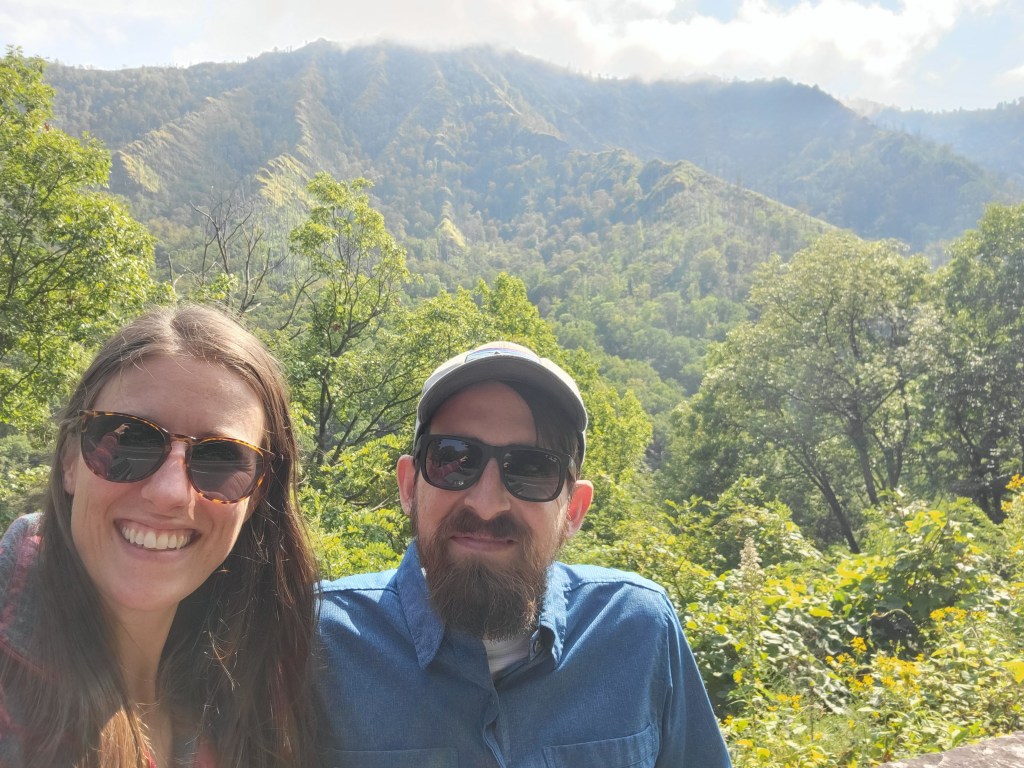
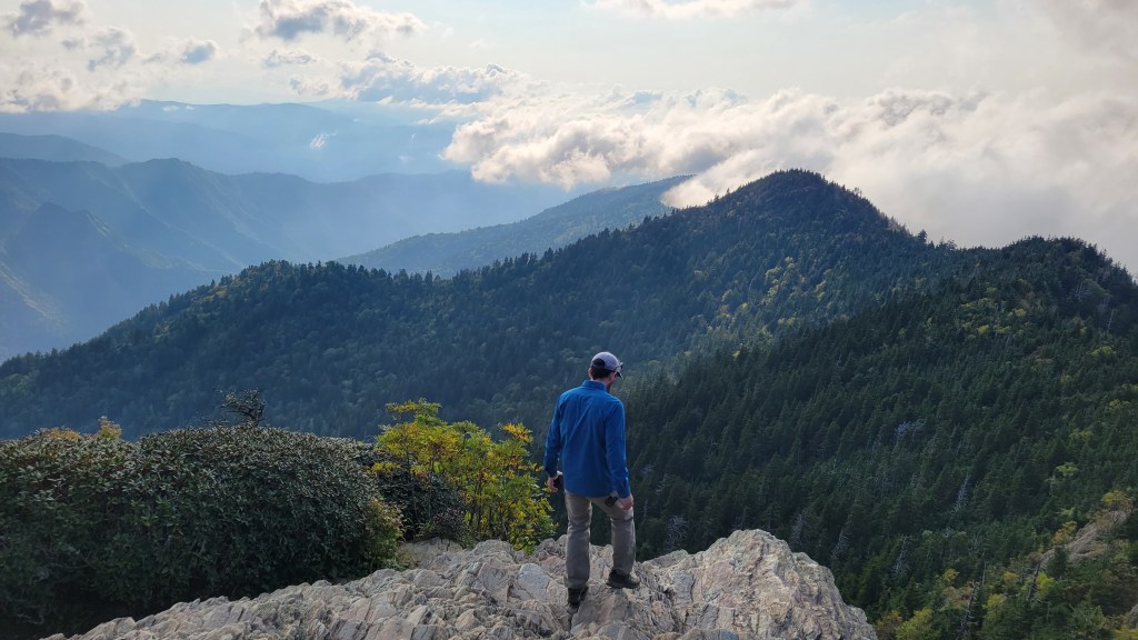
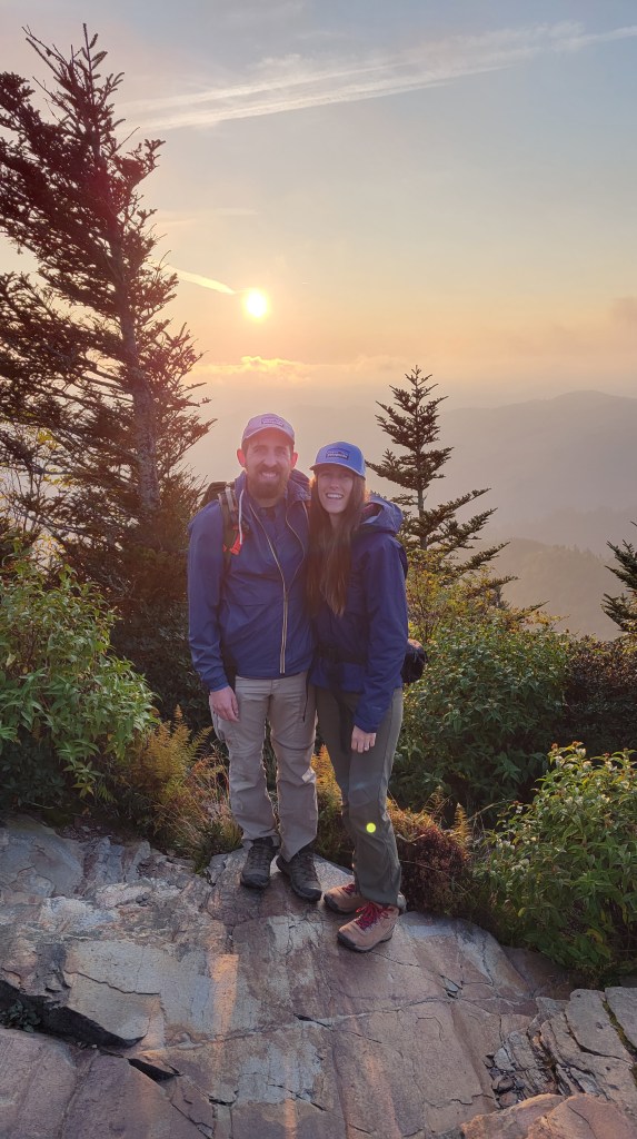
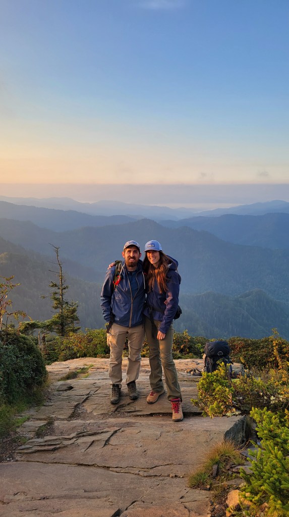
Near the lodge there is a sign that says “Cliff Tops 0.2” so we hiked the short distance to see the view from the peak of Mt LeConte. The ascent felt so easy compared to the rest of the day’s hike because we didn’t have our bags weighing us down. When we got to the lookout, we were the only ones there! Likely because the people staying at the lodge were eating dinner. It was about 2 hours before sunset and the lighting was beautiful. We could see many layers of mountains (my favorite) and the misty “smoke” was blowing around us. It was magical.
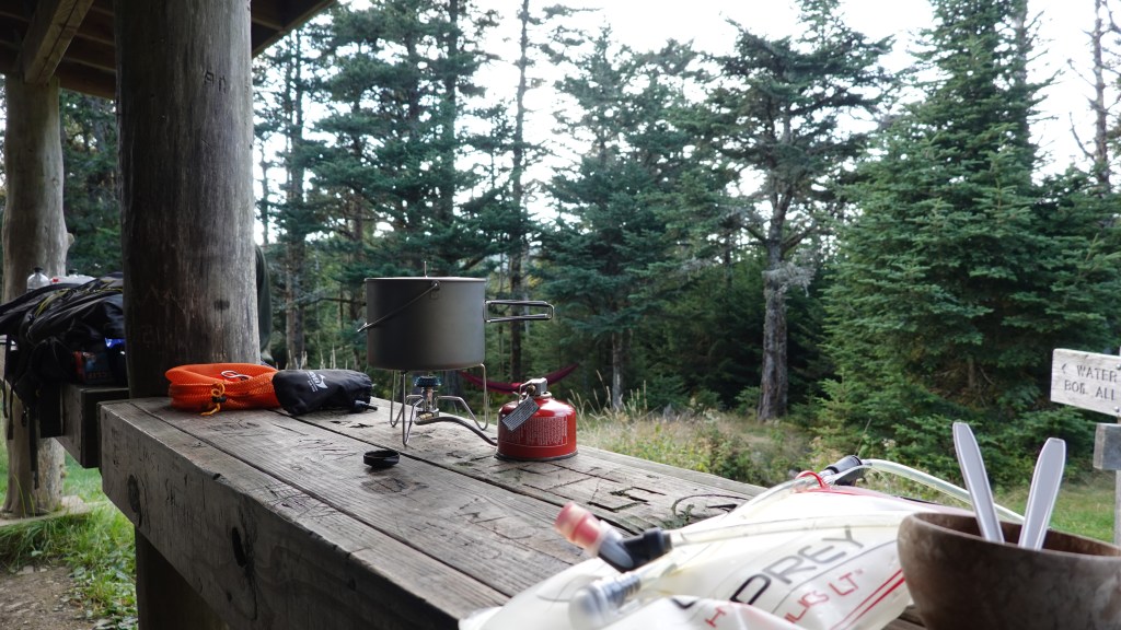
We stayed there for about 30 minutes until another person arrived and we decided to leave so she could experience the peace and beauty alone. We hiked back to camp to make dinner. When camping in places with bears, you need to keep your food away from them. Sometimes this means tying your food bag up on a tree branch, but this shelter had an awesome pulley system to easily raise and lower your food bag. We boiled some water and poured it into our Backpacker’s Pantry meal bag: pasta primavera. It was pretty good, but may have been improved if we had added a little less water so the sauce was a little thicker. Can’t complain about an easy warm meal though!
While we waited for our food to cook, we chatted with a guy staying in the shelter. He is from the area and has hiked every single trail in the park so he was a great resource. We asked him his opinions on different trails we were considering and he gave us some recommendations. I had heard that there was a great place to see the sun rise nearby but I didn’t know exactly where and he told us it was just 0.5 miles down the main trail away from camp. So glad we met him!
After we finished our dinner, we cleaned our utensils, brushed our teeth, and put all of our food and scented items in our bear bag and hoisted it up with the pulley. We were in bed by 7:30pm.
Day 2
The night was silent. No wind, no crickets, no birds, no rain, and thankfully no sticks cracking under the steps of a curious bear. Silence. We slept off and on, not the best but I’ve slept worse. We just couldn’t get comfortable enough to slip into a deep sleep. There was a large mound of earth under us that the cushion of our sleeping pads couldn’t remedy. When we laid on our backs, our feet and head were lower than our chest so you can imagine it wasn’t ideal. If only we could have shifted our tent just a little, but oh well! The temperature in the night was chilly, but not too bad, probably around 50 degrees. Our sleeping bags are rated for much lower temperatures so we were cozy.
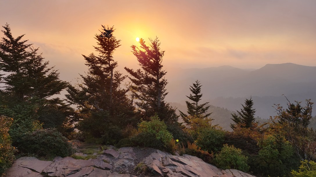
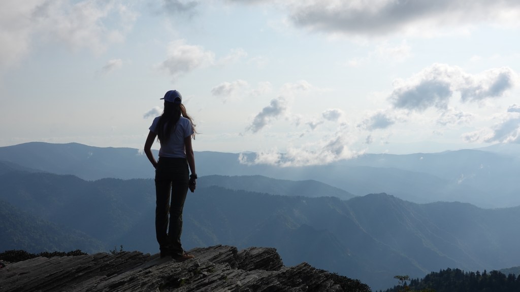
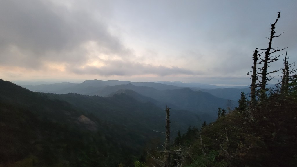
I think I checked my watch at 11pm, 3am, and 6am. At 6:45am, I woke Greg up from his meditative sleep and we got ready to hike 0.5 miles to Myrtle Point to watch the sun rise. We left the tent and most of our stuff, just bringing water, snacks, and our camera. We walked by the light of our headlamps for a little ways before it got light enough to not need them anymore. There were about 20 other people at the sunrise spot who I assume stayed the night at the lodge. At 7:17am we saw a little sliver of bright red sun peek up above the mountains and clouds. It was so beautiful!
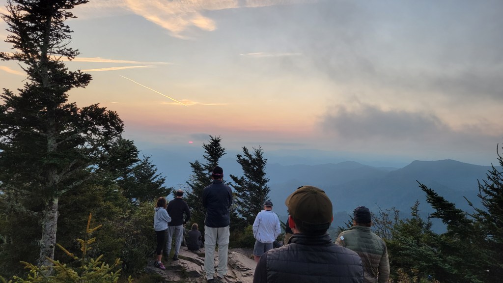


We spent about 30 minutes watching the sun rise further and at one point everyone had left but us! Two guys from our shelter arrived a few minutes later and we chatted with them and took turns taking photos for each other.
We headed back to our campsite and packed up. Before heading back down the trail the same way we came up, we stopped at LeConte lodge to use their bathrooms and fill up our water. Our hike was much easier going downhill all morning than going up the day before. We had perfect weather again and made it back to the bluffs in about an hour and stopped to have a snack.

By noon, we were back to our car and relieved ourselves of our heavy packs. We only had day hikes left in our plans, so lighter packs for the rest of the weekend adventures. From there, we drove to Clingman’s Dome (6,643 ft), the highest point in Great Smoky Mountains National Park and all of Tennessee. There is an observation tower at the top which provides 360 degree views of the surrounding mountains. Since it was Saturday, it was packed with tourists so the parking lot was full. We found a spot along the road to park and hung out on a bench to eat apples and peanut butter for lunch. Near the parking lot is a small visitor center with privies, and beyond that is the 0.5 mile steep paved path leading to the observation tower.
Along the railing of the observation tower were signs labeling the names of the distant mountain peaks. It was really cool to be able to see which one was Mt LeConte where we had been that morning.
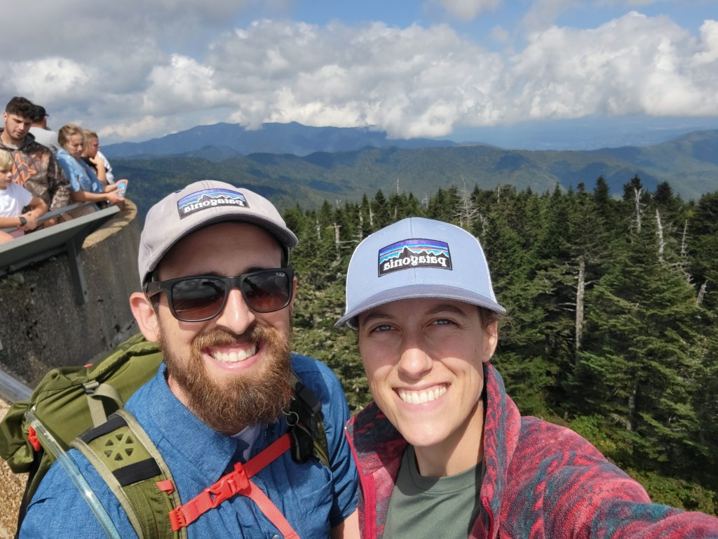
The tower was full of tourists vying for spots to take photos so we didn’t linger. It was difficult enough to read the signs with the names of the mountains because people were blocking them. We were considering doing a short hike in the area and returning to Clingman’s Dome for sunset, but decided it was a little too chaotic with all of the people (especially coming straight from the solitude of the backcountry) and opted to head straight to our campsite for the night at Elkmont Campground.
It took us about 50 minutes to drive from Clingman’s Dome to Elkmont, but it was a beautiful sunny day and we had the windows down while listening to Mt. Joy. We didn’t have cell phone service, but Spotify was still working in the car so it made for a nice drive. As we drove on the final road leading to the campground, a little black bear ran across in front of us! We were far enough away and it was quick enough that we were in no danger of hitting it and it was so exciting to see! We’ve seen a few bears in Shenandoah, but this was our first one in the Smokies!
After checking in with the campground office, we found our spot and set up our tent on the nice level platform. We took a walk over to the supplies shack to see what there was to see and decided to buy a small bundle of wood to make a fire in the pit at our site. They also sold Blue Bunny ice cream popsicles, so we treated ourselves to one of those before walking back to our camp.
We finished setting up our sleeping pads and sleeping bags and sat down at our picnic table to play the dice game, Blisters. The campground was nice and quiet despite most spaces being occupied. There is no cell reception at the campground, but they have bathrooms with running water (but no showers). After backpacking, it’s so nice to have easy access to a sink to brush your teeth!
We started a fire in our fire pit and boiled the water for our dinner over the flames instead of using our little stove. We had another Backpacker’s Pantry meal in a bag, this time vegetarian lasagna. The people at the site next to us sounded like they were making an elaborate dinner with their grill and crock pots, which I’m sure is fun, but we didn’t have to do any dishes afterwards! Because of bears, we were instructed to keep all food and scented items locked in our car. Much easier than hoisting it up in a bear bag. I love backpacking, but it’s nice to do car camping at a campground once in a while.
We spent the rest of the evening enjoying our fire. We didn’t bring any camping chairs, so we just stood or crouched by the fire. At the visitor center on our first day in the park I bought a book called “Long Ago Stories of the Eastern Cherokee” by professional storyteller Lloyd Arneach and we took turns reading a few of the tales by the fire. We were in bed by 9 which is late for us while camping!
Day 3
We slept a little better this night because the ground was more even. Still not as deep a sleep as in our own bed, but that’s to be expected. The campground was nice and quiet all night; the only sounds were the rushing of the Little River and the crickets. We got up and dressed at 7 and had another day of perfect warm fall weather. We left our tent and car and went for a little nature walk near the campground. On the map, we could see a trail that connected to a different section of the campground, and we wanted to see if we could take a shortcut across the Little River to get there. It wasn’t a huge river and we had seen lots of people sitting in camping chairs in the water, but we tried a few times to find a good spot to cross but we would have gotten our feet wet. We decided to walk a little ways further and found a bridge that wasn’t labeled on the map! I have to say, the campground map could be improved. I’m really bad at reading maps, but even Greg said it didn’t make sense in lots of spots!
On our way to the Little River Trail, we stumbled across Daisy Town, a row of cabins built in the 1920s as a nature retreat for rich people. The destination became popular when the Little River Logging Company logged the area and Elkmont was a bustling town. Over time, the logging company left, tourism stopped, and the buildings fell into disrepair. The guy we chatted with at the backcountry shelter on Mt LeConte had told us about a recent restoration project that is working to bring these buildings back to their original state. As we walked down the road, we could see a few were still being worked on, but the rest had the front doors wide open with signs that said “Come on in!” There was no one else around but us, adding to the ghost town feel as we explored each dwelling. There were small signs by each front door that listed who had leased the cabin through the years and it was interesting to see each person’s job title: attorney, son of the mayor, inventor/politician, which reinforced the fact that this was a vacation spot for the wealthy.

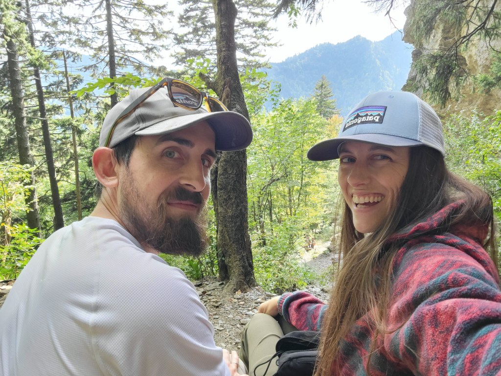
After using the nice bathrooms near the restored Appalachian Clubhouse, we continued on to the Little River Trail. It’s an easy flat trail along the river which was nice because my calves were very sore from the previous day’s descent.

At one point we stopped and found a huge boulder to sit on along the river and had a little snack for breakfast. It was so peaceful and beautiful with the sunlight streaming through the canopy.
We continued on and eventually turned around and headed back to our campsite to dismantle the tent and pack up.
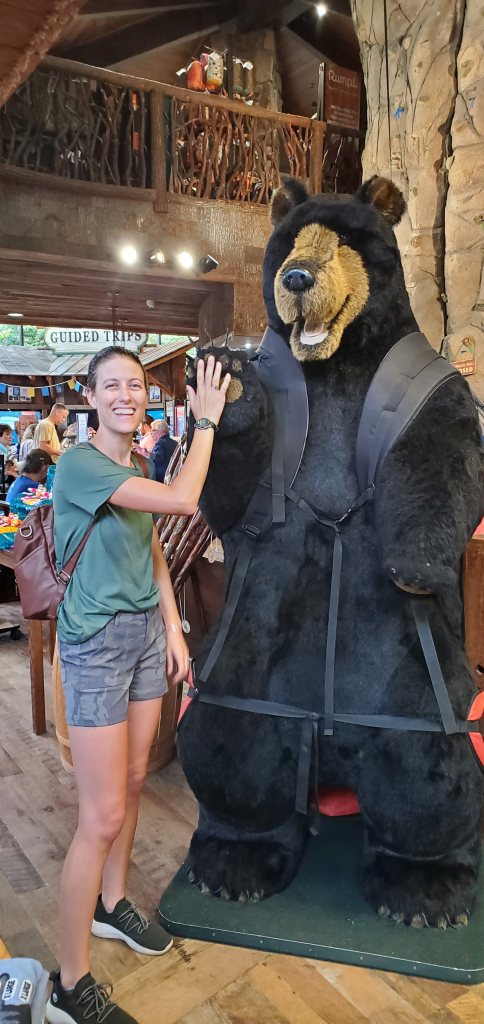
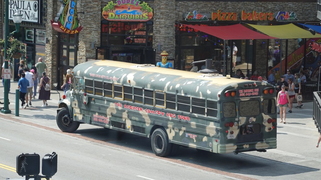
On our way into the park on the first day, we had driven through the main road of Gatlinburg (we drove through Pigeon Forge the night before and it was bonkers!) and it looked very intriguing, so we decided to park there and walk around before heading home. It felt like a Tennessee version of Las Vegas meets Disney World: lots of huge elaborate signs, strange attractions, and chaotic colors and sounds with tourists packing the sidewalks. It’s so odd to have these busy tourist spots juxtaposed against the peaceful park just feet away. There is an obvious barrier when you get to the end of the tourist area and enter the park: from noisy and overstimulating to suddenly quiet and green.

There were a few cute shops tucked in among the more commercial ones and I bought a cute hat from Life is Good that says “Optimistic by nature”. I was deciding between that one and another hat that said “Positive State” that looked like a collegiate hat and I thought it was so funny! After a while I became overstimulated and over hungry and began fading. We quickly found a restaurant called Smith & Son Corner Kitchen where I had the fried catfish with broccoli and it revived me! Around 3pm, we headed home.
There is a lot more for us to explore in Great Smoky Mountains National Park! We hit some of the popular spots, but with limited time we weren’t able to see all corners of the large park. Since we live nearby, we will definitely visit again!
If you want to watch a video of our adventures in Great Smoky Mountains National Park, click on the video below!
Thanks for reading!
-Rebecca
