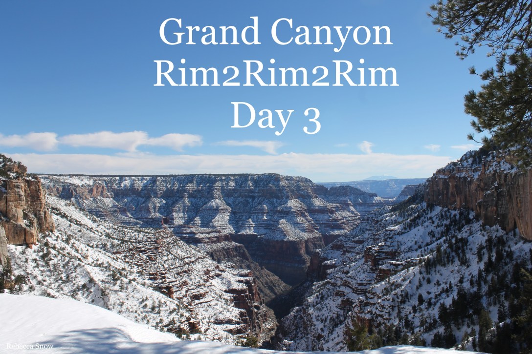
February 1st, 2017
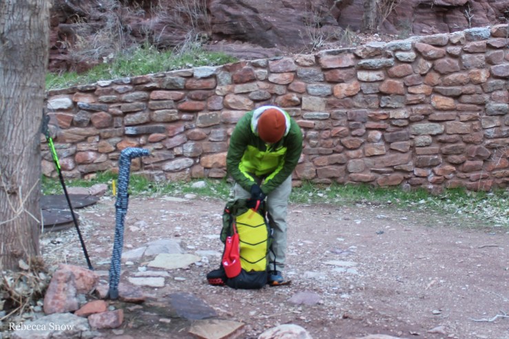
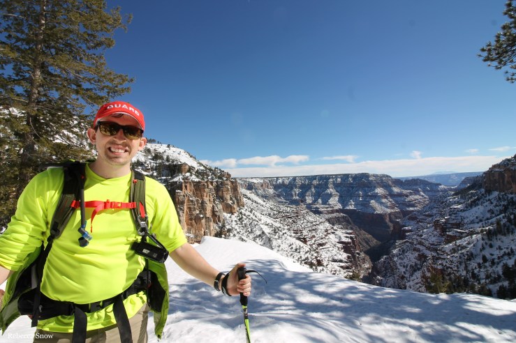
What a day! We left our camp at Cottonwood by 8 am. We only had to carry what we needed on the trail that day. We were able to leave our tent and other supplies at the camp since we would be staying there again that night. It was a weight off our shoulders!
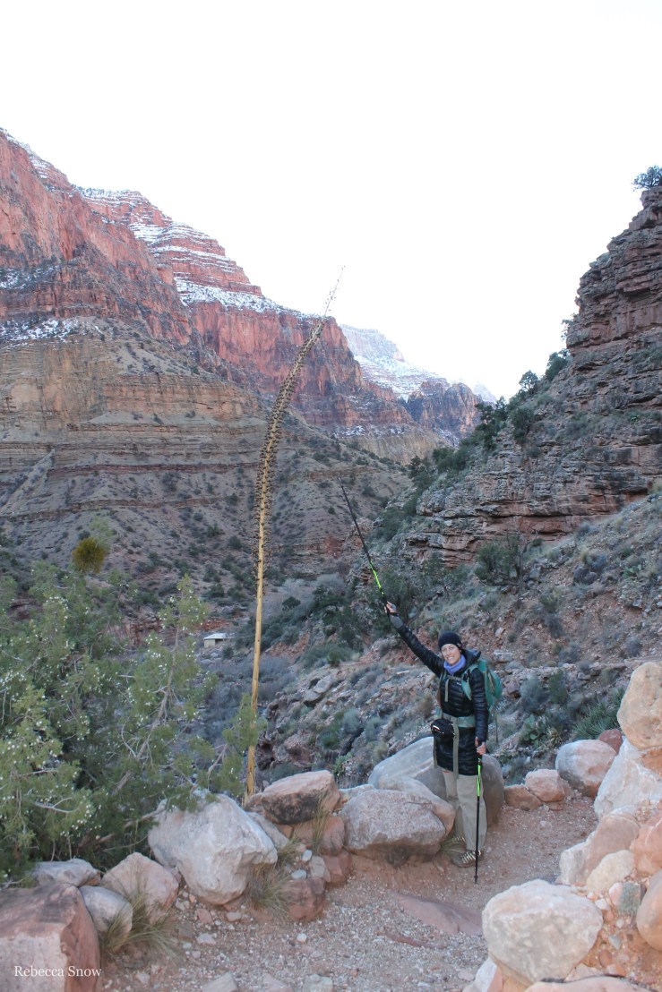
We hiked 1.4 miles and stopped at Manzanita to fill up our water at the spigot since the faucet at Cottonwood was not turned on. My muscles took a little bit to warm up that morning. My calves were still pretty sore from the descent on the first day, but nothing too bad. I think my body just knew we had a long, difficult day ahead!
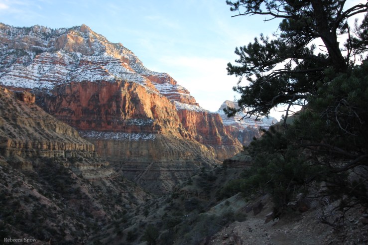
Less than a mile further, we came across Roaring Springs and saw another helicopter! It flew below us, since we were hiking high on a ledge, and landed back at Manzanita where we had noticed a helipad. (By the way, we vlogged our hike as well! Click here to watch the video for day 3!)
Eventually, we put our traction on our boots because it started to get icy. Despite the increasing amounts of snow beneath our feet, the sun was still shining and we were actually pretty warm! While I am beyond grateful for the sunshine that day, it caused lots of snowmelt to fall from the ledges above. There were times when we were hiking and could hear some ice and snow falling and echoing in the canyon. Luckily, we only had one icicle fall on us – and it was tiny! We actually caught our reaction while filming! Check out 11:38 minutes in the vlog. By that point, we were starting to get a little tired and frustrated, so we were a little tense!

When we started the day, we set a hard “turn around” time for 2 pm no matter how far we got. By our calculations, that would give us enough time to make it back to camp before it got too dark and cold – and dangerous.
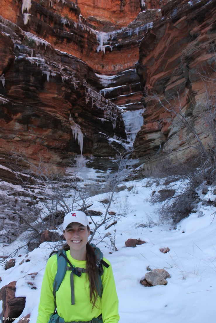
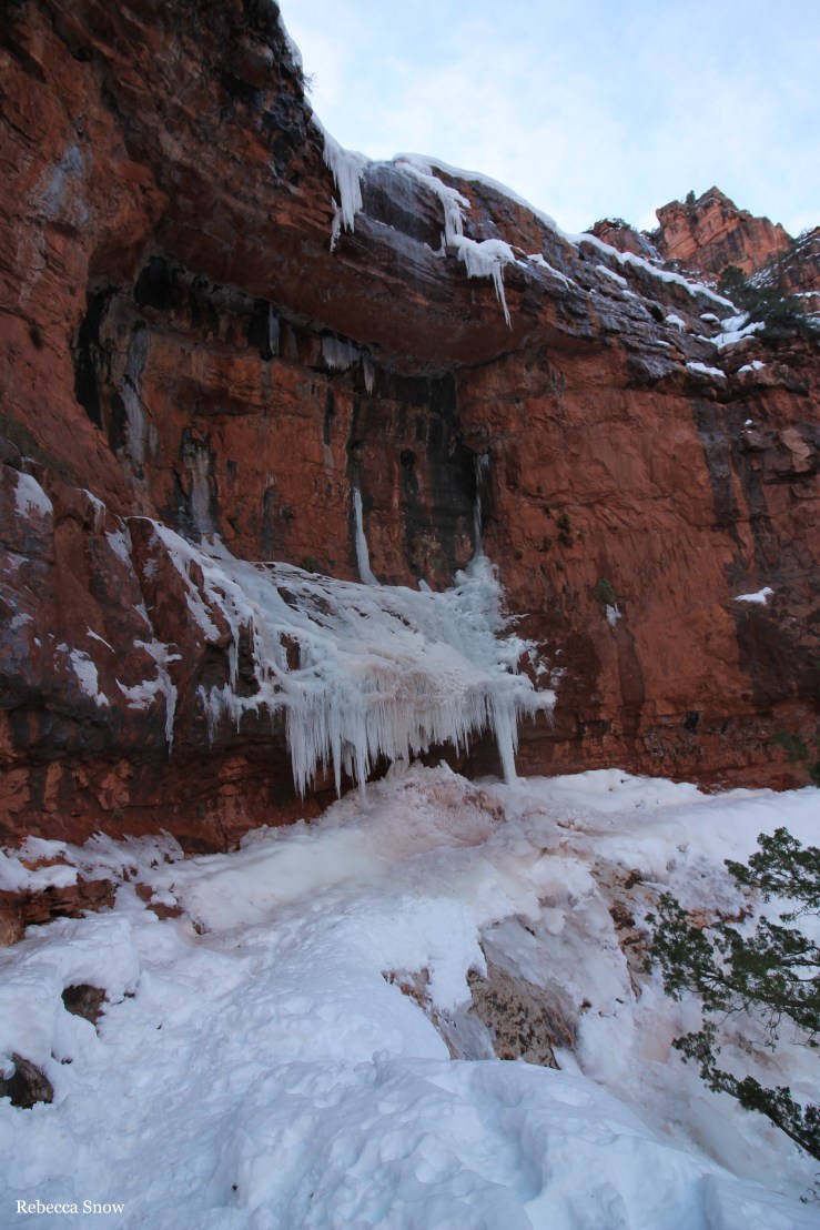
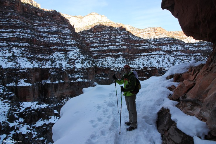
We continued up the snowy path that was growing ever deeper and also encountered several water/ice falls. We aren’t sure if they are always present – it may be that some of these formed due to the snow melting. The icy water would fall down the cliff wall to our left, form of mass of wet ice on the trail itself, and continue to cascade down the cliff to our right. Crossing some of these were pretty harrowing experiences. One slip and you would be falling off a sheer drop. The traction on our boots and having a pair of hiking poles definitely helped, but it doesn’t placate the tightness in your chest as you watch your loved one carefully shuffle along an ice ledge. It gave Greg nightmares!
While it was definitely dangerous, it didn’t feel too dangerous to continue. So we marched onward!
We had heard from the ranger at the Backcountry Information Office that another ranger had snowshoed part of the way up towards the north rim a few days prior to us starting our hike. She made it to the Supai Tunnel (about 2 miles from the top) and turned around. We figured that the snow would have melted a bit more since then, so we made it our goal to at least get to the Supai Tunnel and then see how much further we could get before turning around at 2 pm.
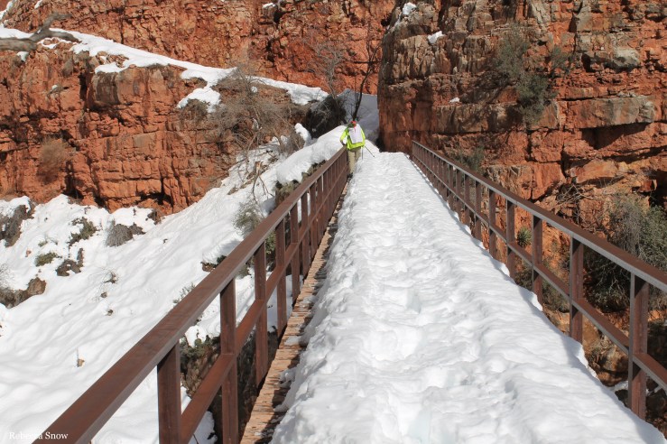
Finally we arrived at the bridge that is 2.7 miles from the top. By this point, the snow was knee-deep in most places. To cross the bridge, we shimmied between the handrail and the knee deep snow. It actually required a lot of concentration because there was a sizable gap at the base of the handrail and it was a long way down! We just took our time.
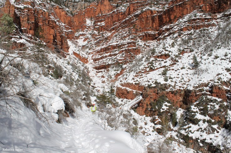
The next step was seemingly endless switchbacks. Switchbacks I can handle, knee-deep snow without snowshoes is another beast! Most of the steps we took were on top of the snowpack, but every few steps the snow was a little weaker and your foot was sink into the snow. That got old real fast, but we pressed on. One foot in front of the other. Mind over matter.
I was beginning to think this tunnel did not exist!
But eventually we made it!
There was a mule hitch post and a privy just beyond the tunnel, so we decided to take a quick break. I needed to wring out my socks! The snow was still getting deeper the higher up we went, but it was 60 degrees and we still had about 2 hours until our turn around time so we decided to keep pushing and just see how close we could get.
By this point, the snow was waist deep, and every other step caused your foot or your pole to sink in. Talk about frustrating! Every time your foot sinks in, you basically need to crawl back out of the hole! We were following one set of footprints from a hiker who had tried to reach the north rim the day before and one set of snowshoe prints from a man who had apparently snowshoed down from the yurt a few days prior.
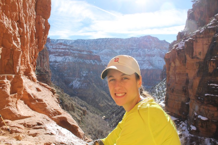
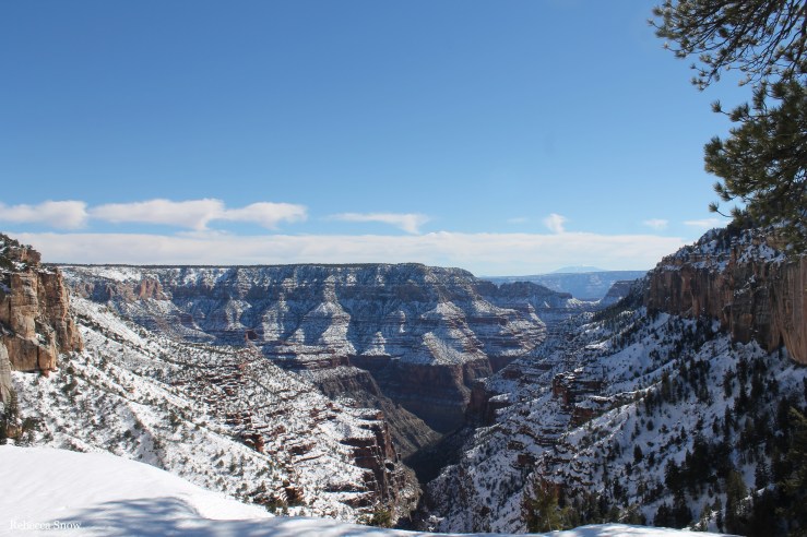
We finally made it to a vista called Coconino Overlook and stopped to take some pictures and enjoy the view.

We didn’t know how close we were to the top since our map didn’t have this marked, but we figured we had to be close. We had 10 minutes until we had to turn around. We kept going up several more switchbacks, painstakingly placing our boots in places where we hoped we wouldn’t sink in – and more often than not our foot would sink. At 2:15 pm, the footprints ended and only snowshoe prints remained. The other hiker must have turned around at that spot the night before. We were almost above the trees and we must have been just another switchback or two away from the trailhead, but we decided to be smart and turn around so we wouldn’t have to hike in the dark. It also didn’t help that every frustrating step we took towards the top meant we had to take that many more steps down to get back to camp.
So – we made it to the north rim!!
We slowly made our way back down to the Coconino Overlook and Greg gave me another envelope titled “At the Zenith.” The third letter! It talked about reaching our goals together no matter how hard the climb. You’ll see in the video after he gives me the letter he asks me to film him saying something that’s “not rehearsed.” My brain is thinking, “Is he going to propose?” So I’m holding my breath waiting to hear what he has to say…. and he does an impression of his track coach! I completely forgot he had planned to film a little speech when we reached the top, similar to one his coach used to say about how runners witness awesome views because they go the distance. I wanted to laugh out loud and tell him what I thought he was going to say, but I didn’t – I was too embarrassed! Watch the video and tell me you didn’t think the same thing!
Anyway, we kept on going down the mountain, one sinking step at a time. I am not a person that gets angry, but I felt anger then! Not at anyone or anything, it was just frustrating because it felt like there was someone invisible pushing you down every step you took. I just had to keep telling myself that the hiking would be faster going down and we’ll be at camp soon enough. We made it back to the Supai tunnel at 3 pm and Greg helped me wring out my socks again. We layered up because the sun was dimming and temperature was creeping back down. Greg was getting a little concerned that my feet were so wet, but it was warm enough and we were moving enough that I don’t think we were in any danger of frostbite. It was a valid concern if we ended up hiking in the dark, though!
We carefully descended all of the switchbacks and the bridge and the nightmare waterfalls.
Finally we made it to Roaring Springs where there was no ice and we could take our traction off! Morale was growing with each step that we took toward camp as we raced against the sun.
We stopped quickly at Manzanita to fill up our water again since we wouldn’t have any at Cottonwood.
At 6 pm, we were greeted at camp in the light of dusk by our friends who were glad to see us. We had last seen them around 12:30 pm at the Supai tunnel when they turned back and they knew we were going to turn around at 2 pm. We had made it the furthest out of all the hikers at Cottonwood that were attempting to make it to the very top. There was a group of snowshoers who had planned to stay at the yurt on the north rim, but had turned around when they got to the frozen waterfalls. We felt a sense of camaraderie at camp as the other hikers commented to us that they were happy we made it back safe. We said, “Same to you!” Everyone was glad to be alive! We were all so lucky that no one had gotten hurt.
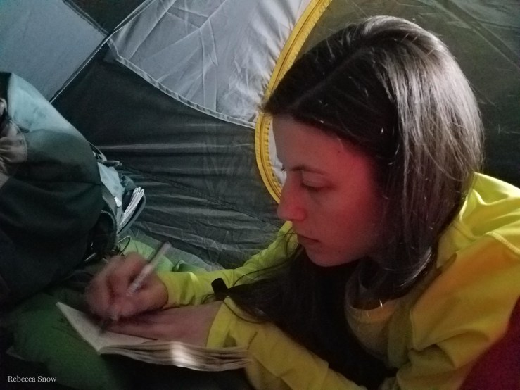
We ate dinner (freeze-dried shepherd’s pie from Backpacker’s Pantry) at our friends’ camp as we all discussed our day. We chatted for a bit and then got ready for bed with thankful hearts.
Day 3 mile count: 13.6 miles (4,241′ elevation gain over 6.8 miles and 4,241′ loss over 6.8 miles). Departed Cottonwood Campground (4,000′) at 8:00 am, turned around above Coconino Overlook (~8,241′) just under the North Kaibab Trailhead at 2:15 pm, arrived back at Cottonwood Campground (4,000′) at 6:00pm.
Thanks for reading!
-Rebecca
P.S. We vlogged our hike as well! Click here to watch the video of day 3!
If you want to read about day 4 of our backpacking trip, click here.
