September 16th, 2016
Our goal was to leave the house by 5:00am, but we ended up making it out the door at 5:30. It was a chilly morning and we actually hit a bunch of traffic leaving Boston at 6 in the morning! We arrived at the Lincoln Woods Visitor Center, put some money in the box to park for a few days, and gathered up all of our gear. It was about 46 degrees so we were eager to get moving! (By the way, we vlogged our hike as well! Click here to watch the video for day 1!)


We were on the trail by 8:30!


The first bit of the trail is a nice and easy 1.4 miles (we will revisit these 1.4 miles on the way back!) The trail runs parallel to the Pemigewasset River and used to be an old railroad so we enjoyed the zero elevation change while it lasted!
From there, the trail turns off to Osseo Trail. This trail leads you 4 miles up to Mt. Flume, the first peak! It was a fairly tough ascent for us because it lasted a while. We had to stop for a snack around 10 and made it to the top by 11.

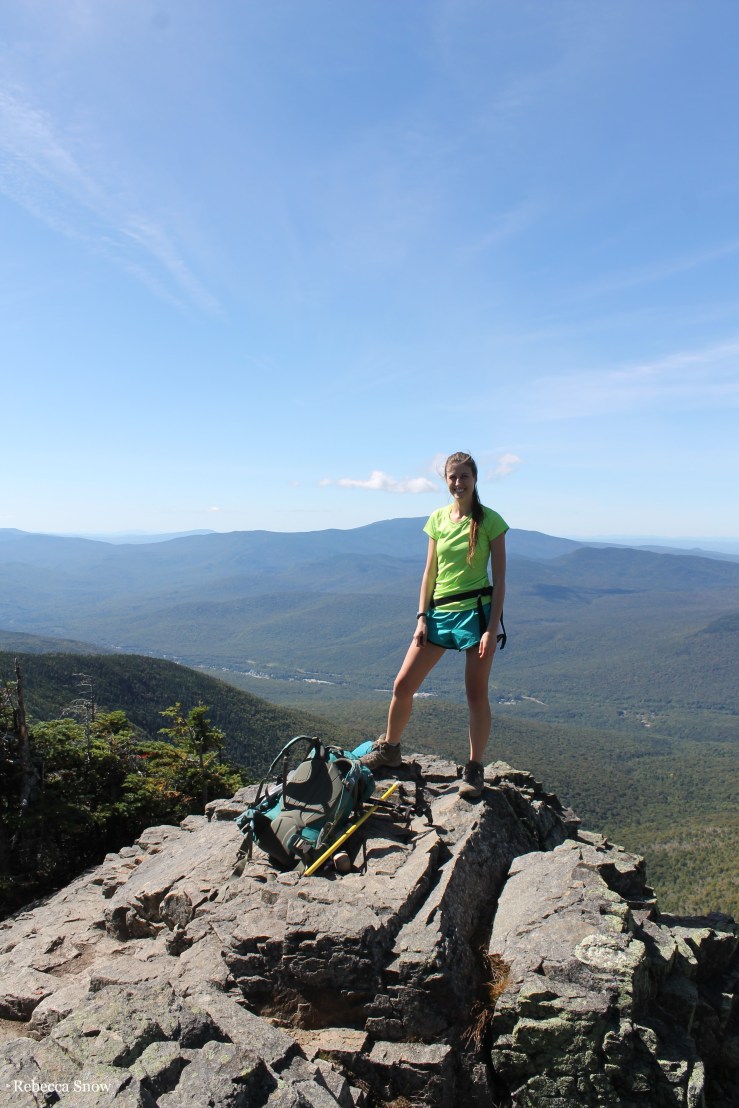
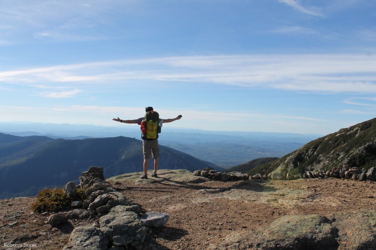
Rebecca, Mt. Flume summit
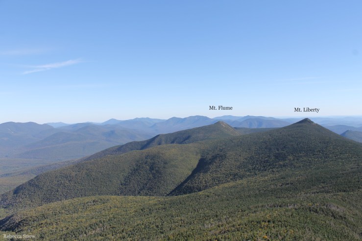
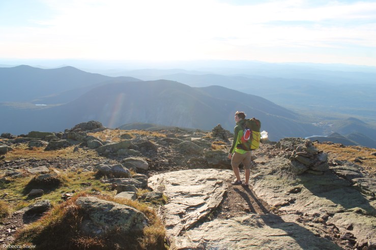
There were a few other people on Mt. Flume with us and they oriented us to the other peaks that we would encounter. We could see people on Mt. Liberty and 1.5 miles later we were looking back on Mt. Flume from the top of Mt. Liberty! It was really cool to reach the peaks and see where we came from and where we will go. It makes you feel really accomplished because the previous peak looks so far away! It can also be discouraging because the next peak does too!
We snacked on some trail mix before heading down Mt. Liberty to get some water at the Liberty Spring. The spring was 0.3 miles off the trail by the Liberty Spring campsite. It was very steep so, even though it was only a short distance, we decided to leave our packs by the main trail (hidden in the trees) and hike down with just our filter and water bottles. Any relief from wearing the large pack is welcome indeed! We had to stop at this spring because the next phase of the trail was up on a ridge and we wouldn’t encounter any water sources until the next day.


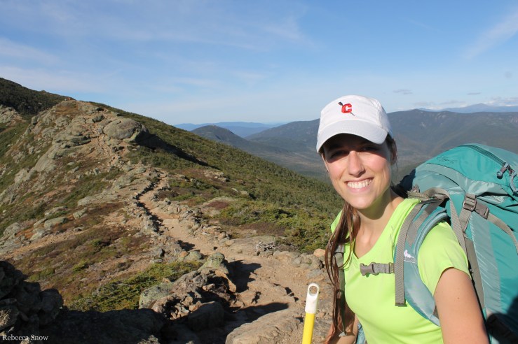
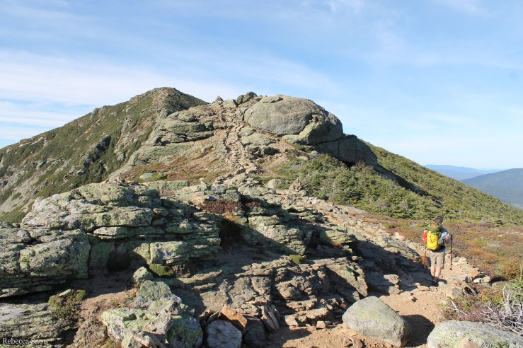
Once we were stocked up on water, we headed up the ridge to conquer Little Haystack, Mt. Lincoln, and Mt. Lafayette. We have never hiked on such exposed terrain like that before and the views were spectacular! The path is all rocks and gravel lined with short trees and other hardy vegetation, which allows for 360 degree views. Naturally, trees have a difficult time growing up there because of the harsh conditions. Many of the trees had branches all pointed to one side, making it look like it was being blown by gale-force winds even when it was fairly calm.


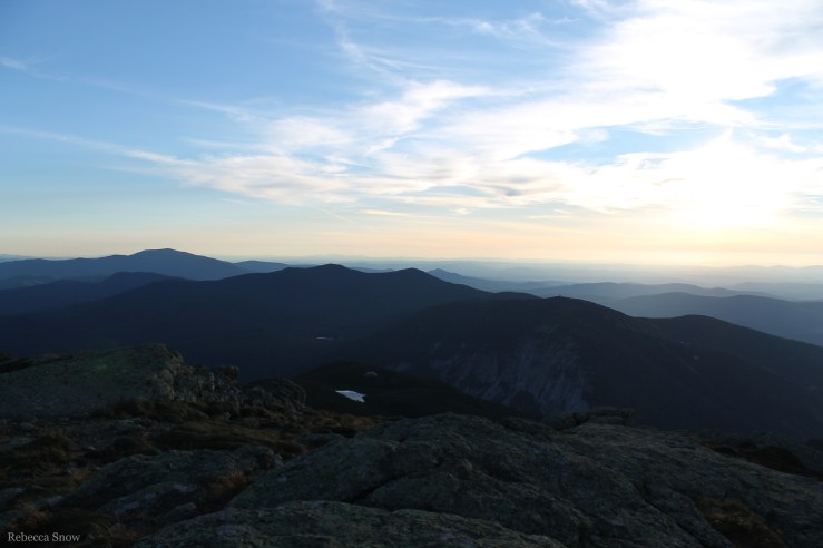
As we hiked along the ridge, we could see the sun getting lower. It was beautiful, but slightly anxiety-inducing as we didn’t want to be on the exposed ridge after dark. The next campsite was on the other side of the next peak, Mt. Garfield, but we weren’t planning on making it that far. We just had to make it off of the ridge and down below the tree line a ways until we could find a flat area off the trail to make camp. Personally, we find descents slower and more difficult than ascents, so after a long day of hiking we were making steady but slow progress down from the ridge. We were climbing down huge boulders and as much as we wanted to go faster, it wasn’t possible to lug the weight of our packs on our tired ankles and toes any quicker than we were going.
Finally, we came across a campsite from a couple and their dog who we’d seen ahead of us on the ridge. That gave us hope that we could find a tent-size spot for us as well. We put our headlamps on as we continued to hike along in the dark. We had to watch our footing on the rocks, but we also had to make sure we were scanning along the sides of the trail for a spot to camp. Eventually, Greg spotted a narrow trail jutting off the edge of the trail that led to a tiny clearing. It was surrounded by trees, but they didn’t really have big branches. More like surrounded by giant toothpicks with spiky toothpicks lining the trunks. It would do! We set up our tent, which thankfully fit, and I got started putting together our bedding while Greg prepared dinner.
It was already pitch black, we were exhausted, and it was getting cold. As much as we wanted to sit and enjoy our dinner, we ate hurriedly so we could hunker down in our sleeping bags and sleep! We ate our warm chicken and rice quickly and gathered up the bear bag to search for a spot to hang it. Like I said before, we were surrounded by toothpick trees, so we headed back to the main trail to see if there were any larger branches over there. We wandered around for a while, not wanting to drift too far from the trail for fear of not finding our way back, and eventually came across a branch that was slightly longer and thicker than the others. We cleaned out the cooking pot, brushed our teeth, and closed up the bear bag. Gingerly, we hoisted it up and secured it to the trunk. It was probably only 8 or 9 feet off the ground and not far from the base of the branch, but it was our only option. We made our way back to the trail and discovered we had hung the bear bag a shorter distance from the main trail than we thought. Oh well!
We finally got into the tent and were organizing the rest of our gear when Greg looked up at me in horror and pulled out his bag of lunch/snacks. Nooooo! We both had forgotten that our snacks were in our bags. They needed to go in the bear bag so we gathered our will and headed back out into the cold, dark night. We carefully lowered the bag down because we didn’t want to break it and be forced to search for another rare branch. We threw the snacks in, lifted it back up, tied it down, and scrambled back into the tent. Nothing like the fear of a bear visit to spur you to get out of your warm tent to put the snacks away!
As we settled our aching bodies into sleep, I noticed how quiet it was! I’m used to quiet nights in the country, but normally it’s interrupted by crickets, bullfrogs, Canadian geese, foxes, or other nocturnal critters. All I could hear up on the mountain was the wind! I guess the crickets don’t like to hang out in the alpine zone.
Day 1 mile count: about 11.9 miles
- Lincoln Woods Trail = 1.4
- Osseo Trail to Mt. Flume (4,328′) = 4.1
- Mt. Flume to Mt. Liberty (4,459′) = 1.5
- Liberty Spring and back = 0.6
- Mt. Liberty to Little Haystack (4,760′) = 1.8
- Little Haystack to Mt. Lincoln (5,089′) = 0.7
- Mt. Lincoln to Mt. Lafayette (5,260′) = 1.0
- Mt. Lafayette to our campsite = about 0.8
Thanks for reading!
– Rebecca
P.S. We vlogged our hike as well! Click here to watch the video of day 1! Click here to watch the video for days 2 & 3!
If you want to read about days 2 and 3 of our backpacking trip, click here.
If you want to read about our preparations for our backpacking trip, click here.

Enjoyed watching and reading your pemi experience. Looking forward to doing the same this year.
LikeLike
That’s great! I’m glad you enjoyed the blog and vlog. Happy trails! 🙂
LikeLike